"A People's Guide to New York City" is a collaborative class project undertaken by NYU students in Wendy Cheng's Fall 2009 course, "Race, Space, and the Production of Inequality." Taking inspiration from the book project A People's Guide to Los Angeles (Pulido, Barraclough, and Cheng; forthcoming) students researched, visited, and photographed sites in New York City that illustrate the workings of racism, power, and inequality in the landscape. We hope you enjoy browsing our "alternative guide" to NYC and welcome your comments!
Varick Detention Center, Greenwich Village, Manhattan.
The Federal Government runs numerous Immigration Detention Centers and other facilities for detention under the Federal Bureau of Prisons, an agency of the United States Department of Justice and under Unites States Immigration and Customs Enforcement (ICE).Many of these detention centers are located within New York City’s five boroughs.Two important detention centers have made national news after the wake of 9/11 for the mistreatment of inmates, harsh living conditions within the facility and questions on the suspension of civil rights.This has since offered the idea that such prisons act as ‘domestic Abu Ghraibs’ where the government’s judicial “state of exception” (as we have seen in Guantanamo Bay and in Giorgio Agamben’s pieces) allows for the mistreatment of inmates and the suspension of their rights. One such prison, the Metropolitan Detention Center is located in Sunset Park, Brooklyn.This facility has come under harsh scrutiny from alleged and documented cases of abuse and mistreatment by the police working in the Federal Detention Center.Security camera video footage has captured mistreatment and physical abuse used against the inmates by the police.
Another facility, the Varick Detention Center may even strike chords close to home.It is physically located just a handful of blocks west of New York University’s campus in New York City’s own community of Greenwich Village.The imposing building with guards at each entrance tells a similar story.This facility, “a 250-bed dormitory style facility, which houses only adult male aliens (criminal and non-criminal),” is run by Immigration and Customs Enforcement (ICE) and deals with anyone (United States citizen or non-citizen) that has been detained in New York City that has any sort of citizenship issue.Whether it is a person with no papers, a person who overstayed their visa, even allegations of persons with U.S. citizenship being detained, the Varick Detention Center will hold that person until the issue is resolved.Conditions within the facility have also been reported to be extremely hot in the summer. The New York State Bar Association, the State’s largest organization of lawyers has attempted to address the situation by recognizing the troubles associated with this facility. Many detainees, immigrants with little connections around the country and little awareness of institutions such as these are processed at the Varick Street facility and subsequently shipped off to another domestic detention facility away from the city, either upstate or out of state. For the detainee, this seriously complicates the process of upholding ones basic rights as an inmate: speaking to a lawyer, keeping contact with family as to inform them where the detainee is located, etc., etc. This story is all too common.What further complicates this story is how the Varick Detention Center is deeply intertwined with American Indian communities in the United States today.The Varick Street Detention Center is run and operated by the U.S. government but under contract with a wholly-owned, for profit, subsidiary of Ahtna, Incorporated (one of the thirteen Alaskan Native Regional Corporations).Ahtna, Incoprorated was established by Congress under terms of the Alaska Native Claims Settlement Act in 1971.
- Lilly Padia and Michael Charles Staab
Work Cited:
Devon A. Corneal, On the Way to Grandmother’s House: Is U.S.
Immigration Policy More Dangerous Than the Big Bad Wolf for Unaccompanied Juvenile Aliens?, 109 PENN ST. L. REV. 609, 646 n.212 (2004)
Sharon Finkel, Voice of Justice: Promoting Fairness Through Appointed Counsel for
Immigrant Children, 17 N.Y.L. SCH. J. HUM. RTS. 1105 (2001).
Mark T. Fennell, Preserving Process in The Wake of Policy: The Need for
Appointed Counsel in Immigration Removal Proceedings, 23 NOTRE DAME J.L. ETHICS &
PUB. POL’Y 261, 287–88 (2009)
Beth J. Werlin, Note, Renewing the Call: Immigrants’
Right to Appointed Counsel in Deportation Proceedings, 20 B.C. THIRD WORLD L.J. 393,
393–94 (2000)
IMPORTANT CASES:
Donald Kerwin, Revisiting the Need for Appointed Counsel, INSIGHT
(Migration Policy Institute, Wash., D.C.), Apr. 2005
United States v. Mendoza-Lopez, 481 U.S. 828, 832 (1987); United States
v. Barraza-Duarte, 265 F. App’x 553 (9th Cir. 2008)
Cano-Merida v. INS, 311 F.3d 960, 964–65 (9th Cir. 2002)
United States v. Arrieta, 224 F.3d 1076 (9th Cir. 2000); Jacinto v. INS, 208 F.3d 725 (9th Cir.
2000).
Families for Freedom v. Napolitano, No. 08-CV-40567 (S.D.N.Y.
filed Apr. 30, 2008).
CITY BAR JUSTICE CTR.,
FAST FACTS ON THE NYC KNOW YOUR RIGHTS PROJECT AT VARICK FEDERAL DETENTION
163 East 111th Street, on the corner of Lexington Avenue and 111th Street, one block up from the 110th street 6 train station
El Barrio, also known as East Harlem and Spanish Harlem, has been home to many different ethnic groups throughout the years, but has remained predominantly Puerto Rican since the 1950s. The Young Lords Party, also referred to as the Young Lords Organization/YLO, was founded by a group of mostly Puerto Rican college students in New York City. El Barrio became their home base, so to speak. Originally operating under the name The New York City Young Lords Organization, the group drew inspiration from other social liberation movements happening around the nation at the time. Popularly discussed as a Puerto Rican organization similar or parallel to the Black Panther Party, the Young Lords Party in New York City also drew inspiration from the Young Lords in Chicago—a former street organization that took up the mantle of Latino rights and began community programming and actions in the 1960s.
The Young Lords prided themselves on being accountable to the needs and demands of the community of El Barrio. A famous action was their campaign to remove trash from East Harlem’s streets. When city bureaucracy and services proved insufficient in meeting these basic sanitation needs, the Young Lords mobilized the community, both cleaning the trash themselves and setting it on fire in protest. Other actions included hijacking and operating a medical-services truck in the neighborhood, offering free meals and clothing, and teaching liberation classes, among many others. One of their best-known public statements was the occupation of a church in the neighborhood.
The Young Lords took over the First Spanish Methodist Church for 11 days, beginning on December 28, 1969. The church is located at 163 East 111th Street, on the corner of Lexington Avenue and 111th Street, one block up from the 110th street 6 train station. Since this neighborhood was (and remains) predominantly Puerto Rican and served as their operating base, they renamed it the “People’s Church.” During the 11 days of the occupation used the church as a hub to provide day-care, health services, free breakfast and clothing, and arts and educational programming to thousands of supporters. The Board of Mediation for Community Disputes played a role in establishing the Young Lords through this occupation; they recognized the YLO’s legitimacy by proclaiming the Young Lords representatives of a particular constituency. In January of 1970, police invaded the church and arrested over 150 Young Lords members. Though the occupation was short-lived, the site remains well known in the East Harlem community for its connection to and legacy of the Young Lords and community activism in El Barrio.
- Lilly Padia and Michael Charles Staab
Works Cited:
Arguello, Martha, "Sisters, Brothers, Young Lords," ReVista, the Harvard Review of Latin America. Volume VIII, Number 18. pp. 43-45. Winter 2009.
Deutsch, Morton. The Resolution of Conflict Constructive and Destructive Processes (Carl Hovland Memorial Lectures Series). New York: Yale UP, 1977. Print.
"Influential Puerto Rican Activist Group the Young Lords Marks 40th Anniversary." Democracy Now! | Radio and TV News. Web. 01 Dec. 2009. <http://www.democracynow.org/2009/8/21/young_lords>.
Melendez, Mickey. We Took the Streets Fighting for Latino Rights with the Young Lords. New York: St. Martin's, 2003. Print.
Palante, siempre Palante! Dir. Iris Morales. Adapt. Faith Jones. Perf. Patria Rodriguez, Young Lords. Third World Newsreel, 1996. Videocassette.
Young Lords. The Ideology of the Young Lords Party. Bronx, NY: The Young Lords Party, 1972. Print. http://www.archive.org/details/YoungLordsIdeology
The Red Hook Community Justice Center is the first multi-jurisdictional community court in the United States. The term “multi-jurisdictional” refers to its simultaneous hearing of criminal, family, and housing cases under one roof and with one judge. Named in LIFE Magazine as one of the nation’s 10 most crack-infest neighborhoods in 1988, the community of Red Hook has long suffered through conditions of drug usage, gang violence, economic and state abandonment, and police-community mistrust. One of the primary goals of the Red Hook Community Justice Center is to reconcile the residents of Red Hook with a comprehensive court system that the community previously perceived as a criminalizing and marginalizing agent.Another goal is to force the justice system away from the “McJustice” trend that New York City saw during the 1990’s under Mayor Rudy Giuliani with his policies of heavy policing and the record number of arrests that resulted.The Center wishes to build a strong community foundation for the community to serve the community.
The idea and need for the Justice Center were realized in 1993, when a Red Hook high school principal named Patrick Daley was gunned down as he searched for a truant student in the Red Hook projects. The first steps for the Center included focus groups, surveying of community residents, establishing an Americorps program designated to hire and train individuals from the Red Hook community, and general open discussions on people’s resistance and attitudes towards court systems in America. The site for the Center was selected by a focus group of community residents who wanted to see this abandoned school building converted into an active community space.
The court and all of the services provided continues to run with federal and private funds allocated to the Center each year.Groups like the Robin Hood Foundation, an anti-poverty organization provides money for the services that are much needed in the community.
Today, the court takes low-level misdemeanor arrests from 3 different precincts in Brooklyn. Run under the jurisdiction of one judge, the court seeks to provide a comprehensive analysis and approach to every case that comes to the Justice Center. From Youth Court to GED courses to drug rehabilitation to health services, the Red Hook Community Justice Center is a community organization first and a court system second.The Center is designed to help build a healthy and informed community and education efforts that empowers the youth to the elderly.Classes on understanding your rights as a citizen are offered by the Center and involve the police in these discussions to create a more open dialogue for understanding.One of the most important aspects of this Center is - you don’t have to get arrested to use the facility, it is open to the community and focuses more on prevention of crime rather than crime stopping.
- Lilly Padia and Michael Charles Staab
Works Cited:
Berman,G. 1998. Red Hook Diary: Planning a Community Court. New York, N: Center for Court Innovation.
Berman, G. and Fox, A. 2005. “Justice in Red Hook.” The Justice System Journal, 261(1):77-90.
Frazer, M.S. 2007. Examining defendant perceptions of fairness in the courtroom. Judicature, 91(1): 36-37.
Henry, K. and Kralstein, D. 2009. Community Court Research: 2009 Update. New York, NY: Center for Court Innovation.
Karafin, D.L. 2008. Community Courts Across the Globe: A Survey of Goals, Performance Measures and Operations. Open Society Foundation for South Africa.
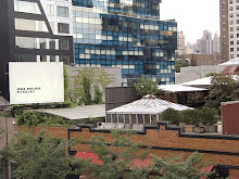
1) Pier 40 public soccer field (Elizabeth Baik and Zoe Ginsburg, 2009). 2) Satellite view of Pier 40 and neighborhood, 2009 (Google). 3) LGTBQ youth rally against private development. 2008 (Source: The Villager. Available from [www.thevillager.com/ villager_251/queers.gif]).
West Houston Street and West Street, Manhattan, New York, NY 10014
Take the 1 train to Houston Street, walk west 4 blocks
A great way to enjoy the scenery of the Hudson River is to visit one of the many piers of Manhattan. Pier 40 is arguably the finest, or perhaps merely the most renovated and tourist-friendly. This pier, “the largest in Hudson River Park, has a footprint of over 14 acres” and is “the starting point of for the historic Greenwich Village walking tour”1. After its completion in 1963, “Pier 40 was used as parking garage, and it continues to be used for that purpose” 2. However, since 1999 there have been reconstructions to provide athletic facilities to the public for little or no charge.
To tourists and those who are unfamiliar with the local neighborhood, Pier 40 appears to be a place for people to park their cars or to play soccer and baseball. However, this site and its recent signs of changes have particular significance to the LGBTQ youth group that identifies the area as a place where they belong.
The group known as Fabulous Independent Educated Radicals for Community Empowerment (FIERCE) is an organization for LGBTQ youth of color in New York City. They are “dedicated to cultivating the next generation of social justice movement leaders who are dedicated to ending all forms of oppression” 3. A member of FIERCE who recognizes herself as a young queer woman of color describes Pier 45 and its surrounding neighborhood as “a place where LGBTQ youth go to relax, hang out with friends and form family” 4. She is able to “feel affirmed” in who she is and feel comfortable about her sexual orientation.
With such attachment to the nearby space, members of FIERCE were galvanized to fight against gentrification of Pier 40. In response to recent move for private development of Pier 40, FIERCE has been campaigning to be part of the redevelopment decision-making process, because any changes made to the pier would impact the community they live in or identify with. In 2008, they launched“their S.P.O.T Campaign to include a 24-hour, L.G.B.T. youth, drop-in center in Pier 40’s redevelopment plans” 5. Despite their efforts, there have been numerous incidents in which LGBTQ teenagers were policed and removed from the area.
In many ways, what is happening at Pier 40 exemplifies processes in New York City at large. Private development and gentrification have removed and dislocated locals who have used a particular space for a long time and identify the space as their own. Gentrification is often associated with urban renewal and revitalization of a ‘dead’ space. The process “always involves the expansion and transformation of neighborhoods through rapid economic investment and population shifts, and yet it is equally implicated with social inequalities” 6. A gentrified area may become more vivacious or aesthetically pleasing. However the process also perpetuates inequality and disadvantages marginal populations.
Present urban restructuring makes us “expect the creation of a bourgeois playground” with “retail and cultural facilities providing recreational opportunities for this population” 7. However, everybody has the right to the city and “will not surrender willingly. […] The mobilization of sufficient power through political organization or in the streets” 8 can change things. FIERCE activity and participation for Pier 40 demonstrates activism that can make a difference.
- Elizabeth Baik and Zoe Ginsburg
Notes
1 “Pier 40” Available from [http://www.hudsonriverpark.org/explore/pier40.html].
2 “Pier 40 Editorial Review” Friends of the Hudson River Park. Available from [http://www.nyc.com/arts__attractions/pier_40.1028362/editorial_review.aspx]
3 “About FIERCE” Available from [http://www.fiercenyc.org/index.php?s=75]
4 Bribson, Emerson. “Op-Ed: LGBTQ youth fight gentrification along Manhattan's historic piers.” WireTap Magazine. May 3, 2009. Available from [http://www.wiretapmag.org/stories/44165/]
5 Mann, Lucas. “L.G.B.T. youth group fights fiercely for a S.P.O.T. to drop in at Pier 40 in the Hudson River Park” The Villager. June 2008. Available from [http://www.thevillager.com/villager_268/lgbtyouthgroup.html]
6 Davila, Arlene. Barrio Dreams
7 Neil Smith, “Gentrification, the frontier and the restructuring of urban space,” in Susan Fainstein and Scott Campbell eds., Readings in Urban Theory, 338-358 (Blackboard).
8 David Harvey, “The right to the city,” International Journal of Urban and Regional Research, 27, 4, 2003, 939-941
1) View of Hospital Complex from Main Island (Elizabeth Baik and Zoe Ginsburg, 2009). 2) Aerial view of Ellis Island Complex. A through F are hospital complex buildings. 1999 (Source:www.galvinized.com/ ellis/index.html). 3) Inspection Line at Ellis Island. (Source: http://www.nieman.harvard.edu/newsitem.aspx?id=100105)
Directions: Take the Ferry from Battery Park or New Jersey Liberty State Park
Medical facilities were needed for America’s biggest immigration center to protect both the health of immigrants, and more importantly, of the nation. The first hospital building opened on Ellis Island in 1902. It was to become the largest, most modern hospital in New York. The contagious disease hospital had 18 wards for particular contagious diseases, and there was a psychiatric hospital as well. Two additional islands were built to house what would grow to be a 22-building hospital complex1.
Upon arrival, each immigrant was inspected by a doctor of the Public Health Service (PHS), and those with visible health or mental problems pulled out of the line for further inspection2. If they possessed a disease that warranted deportation, they were either sent to the hospital at the patient’s expense or immediately deported to their home country.
Along with a physical diagnosis, each prospective entrant was inspected for signs of mental deficiency and submitted to intelligence testing. Deportation also awaited those who were diagnosed as “feeble-minded.”Diagnosis of feeblemindedness was highly subjective and often thinly veiled attempts to keep those deemed undesirable out. Diagnostic tools went from the outrageously inaccurate (those that relied on language competency) to extremely subjective (ability to do puzzles in a certain amount of time and facial expressions). Eugenicists formed part of the ranks of the PHS3. Inevitably poor Eastern Europeans, Jews, and Italians were feebleminded more often than Western Europeans or those traveling in 2nd or 1st class.
The diseases that warranted deportation also changed according to the political climate surrounding immigration. The number of conditions requiring deportation, including diseases, grew 4. As public opinion surrounding immigration changed, so did the criteria used to evaluate possible entrants on the basis of health. Healthiness and medicine are not static categories, but rather are influenced by and further contribute to hegemonies of physical normalcy and morality, particularly race-based state projects5. The medical exam became “aligned with the forces demanding,” for example “fit industrial citizens, usually to the benefit of industry” 6. Public health was used as a norm with which to enact differential rights and to mold spatial geographies.
Immigrant bodies were seen not only as carriers of disease, but of moral degeneracy. Class, race, and urban problems were conflated and projected onto immigrant bodies. Exclusion of those convicted of “crimes of moral turpitude”, prostitutes, and “the mentally retarded, contract laborers, persons with "dangerous and loathsome contagious disease," paupers, polygamists, and the "feebleminded" and "insane," as well as Chinese laborers…articulated concern over the admission of real and potential public charges as well as late nineteenth-century beliefs, derived from Social Darwinism and criminal anthropology, that the national body had to be protected from the contaminants of social degeneracy”7. Therefore, those unlikely to find work were denied entry. Women were similarly instructed on how to care for their children and “good, American ways”8.
Ellis Island Hospital provided opportunities to women of a certain class, while simultaneously reinforcing female dependence. Many incomers were understandably uncomfortable being examined by male doctors, and the PHS began hiring female physicians in 19149. At the same time, women traveling alone were detained until a male family member was able to collect them, as they were assumed to become public wards without the support of a male family member10.
After decades of neglect, the hospital buildings are currently undergoing stabilization and renovation. They are destined to house non-profit organizations, or a conference center, not a museum dedicated to this bittersweet chapter in United States history11.
5 Shaw, Nayan. Contagious Divides: Epidemics and Race in San Francisco’s Chinatown. Berkeley, Los Angelos, London: University of California Press, 2001.
6 Fairchild, Amy. Science at the Borders: Immigrant Medical Inspection and the Shaping of the
Modern Industrial Labor Force. (pp. 7). Baltimore: Johns Hopkins University Press,
2003.
7 Ngai, Mai M. “The Strange Career of the Illegal Alien: Immigration Restriction and Deportation Policy in the United States, 1921-1965.” Law and History Review 21.1 (2003). Available from [http://www.historycooperative.org/journals/lhr/21.1/ngai.html].
8 Conway, Lorie (pp. 91).
9 University at Buffalo—the State University of New York. (Jan. 21 2003). Doctors at the Gate:
The U.S. Public Health Service at Ellis Island: An Exhibit commemorating the
Bicentennial of the U.S. Public Health Service. Retrieved from [http://ublib.buffalo.edu/libraries/e-resources/ebooks/records/7150.html].
11 National Park Service. Ellis Island Development Concept Plan. Available from [http://parkplanning.nps.gov/projectHome.cfm?parkId=277&projectId=18591].
Associated Supermarket. Elizabeth Baik and Zoe Ginsburg, 2009.
229 Knickerbocker Ave, Brooklyn NY.
Take the L train to Morgan Ave, walk South on Morgan Ave. Make a left on Flushing. Make a right onto Knickerbocker Ave, and walk 4 short blocks to the corner of Starr Street.
This local supermarket was forced to pay workers back wages in August for widespread wage violations. The owners, along with the owners of Pioneer Supermarket at 1115 Pennsylvania Avenue, paid “restitution totaling $1,125,000”1. The owners “were also arrested and pleaded guilty to criminal wage theft and falsification of records”2. Violations included lack of overtime pay, paying below minimum wage, and, most egregiously, complete lack of pay for baggers who relied solely on tips.
Bushwick’s racialized spaces, immigrant disenfranchisement, connection to transnational economies and labor flows, and local activism collide in the Associated Supermarket incident. The victory resulted from years of grassroots planning and activism, led by the supermarket workers themselves with support from an extraordinary organization, Make the Road New York. They instituted a long-term boycott of the supermarket, and raised community awareness of the exploitation through Make the Road New York’s weekly meetings, bilingual flyering of the neighborhood and long-term protesting at the site. This community led pressure influenced the New York State’s Attorney General’s Office, who instituted, and ultimately won or settled criminal and civil charges against the owners3.
Make the Road New York is a merger non-profit of Make the Road By Walking, a grassroots Bushwick-based organization that focused solely on immigrant welfare recipients, and the Latin-American Immigration Center, whose mission was to “promote and protect human and civil rights of Latino immigrants and encourage their civic participation in New York City”4. Make the Road New York empowers local residents through leadership roles in the organization. Their advocacy includes expanding civil rights, improving health care, youth development, education, as well as workplace justice. It gives local residents, many of whom are either documented or undocumented immigrants, a voice in the larger policy debate and a say in the direction of their own lives.
In fighting against labor violations, local residents reworked hegemonic discourses around citizenship status and racialized labor. Workers stood up for their rights, refusing to remain silent because of their race or legal status. In demanding rights, residents inserted themselves into cultural membership, or citizenship, in the United States. Formal citizenship is not always “a necessary or a sufficient condition for substantive citizenship” in a globalizing world where formal participation in a nation-state is divorced from “civic, political, socioeconomic and cultural rights”5. In claiming rights and inserting themselves as political actors, residents became citizens “in the broadest sense”6. They became Americans, culturally if not formally, through the very act of advocating for their rights.
While the workers were able to transcend some “identities” such as citizenship status and language, their victory was simultaneously aided by racism imbedded in the place of the victory and inscribed on the bodies of the victors. Almost 40% of Bushwick residents are foreign born, nearly 80% of residents are Latino and almost 35% live below the poverty line7. The workers were able to draw commonalities because of historical ghettoization and racialization of the area. Bushwick has a long history of blockbusting, followed by cycles of disinvestment and perceived blight, which contributed to the area’s racial and socio-economic homogeneity8. A relatively homogenous socio-economic base may have mitigated potential fractures in advocacy goals.
- Elizabeth Baik and Zoe Ginsburg
Notes
1 Chan, Sewell. “2 Bushwick Supermarkets Settle Labor Charges.” New York Times. 1
July 2009. Available from [http://www.maketheroad.org/article.php?ID=980].
2 “Winning the Fight Against Wage Theft.” Available from [ http://www.maketheroad.org/article.php?ID=985]
4 Make the Road New York. “Who We Are—Our History. Available from [http://www.maketheroad.org/whoweare_ourhistory.php].
5 Holston, James and Arjun Appadurai. James Holston ed. Cities and Citizenship. “Introduction: Cities and Citizenship.” (pp 4). Durham and London:Duke University Press, 1999.
6 Flores, William V. (2003). “New Citizens, New Rights: Undocumented Immigrants and Latino Cultural Citizenship.” Latin American Perspectives, 30 (2), 87-100.
7 Wikipedia. “Bushwick, Brooklyn.” Dec. 8 2009. Available from [http://en.wikipedia.org/wiki/Bushwick,_Brooklyn]; Furman Center. “State of New York City’s Housing and Neighborhoods 2008.” Available from [http://furmancenter.org/research/sonychan].
8 Massey, Douglas and Nancy Denton. American Apartheid: Segregation and the Making of the Underclass. Cambridge: Harvard University Press, 1998.; Malanga, Steven. “The Death and Life of Bushwick: A Brooklyn Neighborhood finally recovers from decades of Misguided Urban Policies. City Journal Spring 2008 Vol. 18.2. Available from [http://www.city-journal.org/2008/18_2_bushwick.html].
1) 70 Washington Square and York St, before the construction of the BQE highway, 1926 (New York Public Library). 2) A ground view of the BQE expressway, which illustrates its over looming presence, 2009 (Clare Delaney).
Location of the Brooklyn Heights Promenade: The promenade or esplanade runs along Columbia Heights Street from Middiagh Street to Montague St.
Transit: Take the A or C train to High Street. Turn right on Cadman Plaza West, turn left onto Middagh Street, which will leave you to the Promenade.
The Brooklyn-Queens Expressway is part of Interstate 278 and runs from southern Brooklyn in Red Hook, where it connects with the Gowanus Expressway to Grand Central Parkway in Queens. In 1940 Robert Moses, the supposed “master builder,” proposed an expressway linking Brooklyn and Queens to lessen traffic. Moses valued the erection of highways over the advancement of public transportation, and while he oversaw the construction of every major high way in New York (except for the FDR Drive) over many decades, no new extensions or lines were added to mass transit although a few were proposed. In 1944 Congress allocated twenty-five percent of federal highway funds for the construction of new roads in cities, enabling the construction of the BQE (Short). Beginning construction in 1951, the BQE now runs close to the industrial waterfront from its southernmost point until it intersects with Kent Avenue in Williamsburg (National Research Council). The construction of the roadway literally razed large physical areas ofneighborhoods (in some cases totally demolishing entire neighborhoods) and furthermore served to divide other neighborhoods, destroying their character and displacing residents (Short).
Only Brooklyn Heights was saved from the fate of destruction or division served to most neighborhoods by Moses’ Expressway. In the original plan, the Expressway ran along Hicks Street, the trajectory it follows southward into Red Hook. The Brooklyn Heights Association, founded in 1910, lobbied Moses and the City to move the highway west at Atlantic Avenue, nearer to the East River thereby preventing the bisection of their community. The collective organization of many neighborhood residents, in coalition with the Association, persuaded Moses to move construction of the BQE westward and created a promenade, overlooking the river, with majestic views of lower Manhattan. The promenade runs along Columbia Heights Street from Middiagh Street to Montague St, almost the entire length of Brooklyn Heights. The power of the Brooklyn Heights Association came from residents’ affluence and the historical influence of many residents of the neighborhood, which has been described as “New York’s first suburb.” The neighborhood contains blocks filled with charming and historic row houses and mansions built in a variety of styles (Lancaster and Gillon). Brooklyn Heights was saved from ruination because of the political and economic power of their active and long organized community association and the picturesque quality of the neighborhood these qualities are all markers of the neighborhoods white privilege. Unfortunately Red Hook, Fort Greene, Williamsburg and Greenpoint did not have these recourses available.
In these less affluent and more racially and ethnically diverse neighborhoods, despite protest large sections were demolished and replaced by the loud, ugly, pollution-producing Expressway. It is especially glaring in the case of Red Hook where the Promenade could somewhat easily have been continued, or replicated, along Van Brunt Street, but instead at Atlantic Avenue it was moved back to its originally intended route along Hicks Street causing massive destruction and dislocation. Putting an elevated or open-cut expressway through a neighborhood ensures that the surrounding property is unlikely to ever accrue exchange value. The lands’ use value is also severely limited by the Expressway as it uproots many residents and creates an unnatural border. The border changes the existing culture of the neighborhood and “exerts [its own] active influence…[which is] the blight-proneness of zones along the [borders]” (Jacobs). Highways, and other unwanted land uses, are continuously placed in low-income, predominantly minority neighborhoods causing the destruction of these spaces/communities and leaving the population with the documented additional health risks of pollution (Lee). Furthermore it signals the devaluation of the community as a place to be driven though to get somewhere else.
- Clare Delaney and Upahar Rana
Sources
Jacobs, Jane. The Death and Life of Great American Cities. New York: Random House Inc., 1989.
Lancaster, Clay and Edmund Vincent Gillon. Old Brooklyn Heights New York’s First Suburb. Toronto: Dover Publications, Inc., 1979.
Lee, Robert E. “The Size of Suspended Patriculate Matter in Air.” Science Vol. 178 No. 4061 (1972): 567-575.
The National Research Council Committee on Urban Waterfront Lands. Urban Waterfront Lands. Washington: Office of Publication National Academy of Sciences, 1980.
Short, John R. Alabaster Cities: Urban U.S. Since 1950. New York: Syracuse University Press, 2006.
1) Union Square in December with tents of Holiday Market, 2009. 2) Union Square Archival Image: Illustration of Union Square Park in mid-1800s.(Columbia University Park Story Project).
Location: From East 14th Street to East 17th Street between Union Square West and Union Square East. Union Square E becomes Broadway north of the park and is University Place to the south. Similarly Union Square E becomes Park Ave North of the park and is Broadway to the south.
Transit: Accessible by the L, N, Q, R, W, 4, 5, and 6 trains.
For well over a hundred years Union Square Park has been a site for people to lounge, congregate, protest, rest, and more. Our current perception of the park often overlooks the important historical events that have taken place there. The park was built in the 1830s after the Common Council purchased private property to establish an open space (Shapiro). Before the space was made into a public park, it had been co-opted by the wealthy and regarded as separate private space kept “beautiful” by normative standards and by the exclusion of common people. At this time, the park was demarcated by fences positioned against a densely populated city. In 1872, Frederick Law Olmsted redesigned the park to be more accessible to all people by taking down the fencing and creating more open space for mass public gatherings. This led to diverse ethnic groups and lower income citizens to mingling among other classes and allowed Union Square to become a site of political agitation.
In fact, Union Square has a long history as a center for political protest, activism and strikes. The first official Labor Day occurred in Union Square in 1882. At this time the holiday was not a celebration, as it is today, but a protest of twenty-five thousand people demanding an end to the use of child labor, an eight-hour workday, and many also advocating an end to rent obligations (Kayton). In 1886 on International Workers Day thirty thousand gathered in the square. Numerous other protests also attracted tens of thousand of people to protest injustices such as depression era conditions, workers' deaths in strikes, state executions, war, and unfair elections (Kayton). Using Daniel Opler’s definition of a strike as a “cultural act” used by workers to impart and spread their message to other workers, it is clear how important a public protest space is to further proletariat political movements and also clear why the space was now dangerous to those in power. The use of Union Square as a communal gathering space of “radical people” who pose a threat to both the governmental and economic status quo was ended by the 1980s.
During the 80s the city spent $3.6 million in renovations on the Park (Kayton). The renovations both caused and coincided with the surrounding areas transformation from one characterized by “low-rent office buildings, inexpensive stores, and single-room occupancy hotels” (Deutsche) into the Union Square area of today inundated with chain stores and luxury commercial and residential spaces. Coinciding with the renovations to the Park, New York lost over 100,000 blue-collar jobs and “gained over twice that many in the finance, insurance, and other business industries” (Deutsche). At the same time the city was trying to attract an increasingly wealthy population, it was displacing the people who inhabit Union Square, (the homeless) and the surrounding community, by out pricing them through the active encouragement of gentrification. The renovations to the park created a sanitized version of the formerly revolutionary space and paved the way for upscale commercialization. The erasure of Union Squares’ history of social spirit, movements, and protest highlights the connection between architecture, politics and economics.
- Clare Delaney and Upahar Rana
Sources
Deutsche, Rosalyn. “Krzysztof Wodiczko’s ‘Homeless Projection’ and the Site of Urban ‘Revitalization.’” October Vol 38 (Autumn, 1986) 63-98.
Kayton, Bruce. Radical Walking Tours of New York City. New York: Seven Stories Press, 2003.
Opler, Daniel. “Money Business in Union Square: A Cultural Analysis of the Klein’s-Ohrbach’s Strikes of 1934-5.” Journal of Social History Vol. 36 No. 1 (Autumn, 2002) 149-164.
 Graphic by Titilayo Derricotte and Aubrey Markson


